Alander Mountain
A longer trail that rewards the steep final climb with some of the most spectacular views in Western Massachusetts.
Date: Saturday, July 12, 2025. (Rain Date: Sunday, July 13, 2025)
Drop-off Time: 9:00 a.m.
Pick-up Time: 3:00 p.m.
Trailhead: Mount Washington State Forest Headquarters
162 East St., Mount Washington, MA 01258
Distance: 5.8 miles out-and-back
Total Ascent: 1,821 feet
Difficulty: Strenuous. (Gentle for first 0.8 miles, Moderate for next 1.1 miles, and Steep for final 1.0 mile.)Registration for this schedule starts on 06/05/2025 and ends on 07/11/2025
Participants must be 8 years to 14 years old when the program starts.
Mount Everett Summit via Guilder Pond
A hike to the summit of the Taconic Range’s tallest peak, with a pleasant, easy loop around an iconic mountain pond at the midway point.
Date: Saturday, July 19, 2025. (Rain Date: Sunday, July 20, 2025.)
Drop-off Time: 9:00 a.m.
Pick-up Time: 4:00 p.m.
Trailhead: Across from 399 East St.,
Mount Washington, MA 01258
Distance: 4 miles out-and-back, with a loop around Guilder Pond.
Total Ascent: 954 feet
Difficulty: Strenuous. (Moderate climb for 0.9 miles, with a Gentle 0.7-mile walk around the pond, then a Steep 1.6-mile climb to the summit.)Registration for this schedule starts on 06/05/2025 and ends on 07/18/2025
Participants must be 8 years to 14 years old when the program starts.
Mount Everett Ridgeline via Race Brook Falls
Visit one of the Berkshires’ tallest and most-beloved waterfalls, then continue climbing to the ridgeline of the mountain range for the rewarding view.
Date: Saturday, July 26, 2025. (Rain Date: Sunday, July 27, 2025)
Drop-off Time: 9:00 a.m.
Pick-up Time: 4:00 p.m.
Trailhead: Race Brook Falls Trailhead,
South Undermountain Road, Sheffield, MA
Distance: 3.6 mi out-and-back
Total Ascent: 1,230 feet
Difficulty: Strenuous
“Difficult” (1.1 mile of Steep terrain, then 0.7 miles at slightly more Moderate grade.)
Registration for this schedule starts on 06/05/2025 and ends on 07/25/2025
Participants must be 8 years to 14 years old when the program starts.
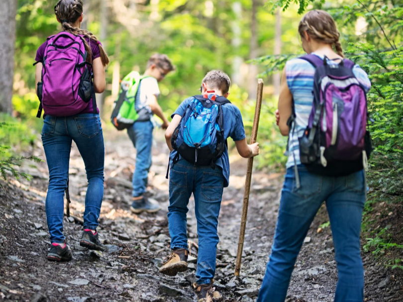
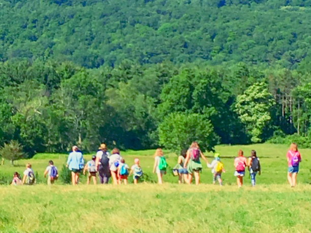
Follow the call of adventure into the mountains of the Berkshires, with professional naturalist Jeramy Vallianos as your guide! Jeramy is a Flying Cloud legend and Berkshires native who returns from the rugged peaks of Patagonia every summer to guide bold young explorers like you to the tops of our tallest Taconics.
Ages 8-14 • $50 per hike • Please ask about Financial Aid
Alander Mountain
A longer trail that rewards the steep final climb with some of the most spectacular views in Western Massachusetts.
Date: Saturday, July 12, 2025. (Rain Date: Sunday, July 13, 2025)
Drop-off Time: 9:00 am at the Trailhead
Pick-up Time: 3:00 pm
Trailhead: Mount Washington State Forest Headquarters
162 East St., Mount Washington, MA 01258
Distance: 5.8 miles out-and-back
Total Ascent: 1,821 feet
Difficulty: Strenuous. (Gentle for first 0.8 miles, Moderate for next 1.1 miles, and Steep for final 1.0 mile.)
Mount Everett Summit via Guilder Pond
A hike to the summit of the Taconic Range’s tallest peak, with a pleasant, easy loop around an iconic mountain pond at the midway point.
Date: Saturday, July 19, 2025. (Rain Date: Sunday, July 20, 2025.)
Drop-off Time: 9:00 am at the Trailhead
Pick-up Time: 4:00 pm
Trailhead: Across from 399 East St.,
Mount Washington, MA 01258
Distance: 4 miles out-and-back, with a loop around Guilder Pond.
Total Ascent: 954 feet
Difficulty: Strenuous. (Moderate climb for 0.9 miles, with a Gentle 0.7-mile walk around the pond, then a Steep 1.6-mile climb to the summit.)
Mount Everett Ridgeline via Race Brook Falls
Visit one of the Berkshires’ tallest and most-beloved waterfalls, then continue climbing to the ridgeline of the mountain range for the rewarding view.
Date: Saturday, July 26, 2025. (Rain Date: Sunday, July 27, 2025)
Drop-off Time: 9:00 am at the Trailhead
Pick-up Time: 4:00 pm
Trailhead: Race Brook Falls Trailhead,
South Undermountain Road, Sheffield, MA
Distance: 3.6 mi out-and-back
Total Ascent: 1,230 feet
Difficulty: Strenuous
“Difficult” (1.1 mile of Steep terrain, then 0.7 miles at slightly more Moderate grade.)
Please contact Flying Cloud Institute if you have any questions.